Delair has unveiled Delair Ag, a comprehensive UAS solution designed specifically for agriculture and forestry, the company announced on 18 February.
Delair Ag will provide a complete, integrated and easy-to-use workflow to collect, manage, analyse and share agriculture data. The UAS will support agricultural companies, service providers and researchers by providing UAS-based data for crop health monitoring, field experimentation analysis, automatic machine guidance, precision agriculture practices or better crop traceability.
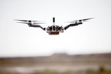
Delair Ag combines the new Delair UX11 Ag fixed-wing UAS and the new Delair Aerial Intelligence (delair.ai) cloud-based platform. The Delair UX11-Ag features the MicaSense RedEdge MX, a fully integrated high-grade multispectral camera to see the plant level of most crops. The sensor generates plant health indexes and RGB colour images and is calibrated for precise, repeatable measurements.
Delair.ai is a comprehensive platform for converting UAS-based images into actionable business insights. The new cloud-based solution provides a complete integrated workflow to manage, analyse and share data for streamlining the aerial surveying process. The industry-optimised analytics can be used in mining, quarries, construction, power and utilities and agriculture industries.
Lénaïc Grignard, product manager for the agriculture and forestry offer at Delair, said: ‘The Delair UX11 Ag combines the productivity benefits of long-range/BVLOS flight operations with highly accurate survey-grade mapping and plant data collection capabilities, while the Delair Aerial Intelligence platform enables a new level of precision agriculture and helps maximise the quality of crops and yields.’