


What’s next for the Pentagon after the Replicator programme?
Although the Replicator initiative has made several accomplishments, there are still multiple gaps to plug across the US Department of Defense (DoD) and its services.

Bluesky has launched a fast response aerial survey service using unmanned aerial vehicles (UAV) or drones. The technology, originally developed by the military, includes Artificial Intelligence (AI) guided autopilot, high resolution integrated camera and environmentally friendly rechargeable propulsion system, the company said in a 23 May, 2012 statement.
Potential applications of Bluesky’s UAV solution include open cast mines or quarries or even landfill sites where large volumes of material are extracted or moved on a regular basis. The geographically accurate imagery would provide a record of activity at a given point in time and the highly detailed height models could be used to measure stockpiles, cut and fill volumes and for facilities management and safety monitoring. Autonomous take-off and landing ensures the system is easy to use and with a wingspan of less than a metre it can be transported without the need for complex assembly.
Large scale construction sites can also be surveyed, at regular intervals or predetermined points in time, providing data for project management, reporting and funding, the company said. The height data can be used for line of site calculations to ensure compliance with planning applications or cut and fill calculations for project invoicing and for the creation of realistic 3D images for marketing or KPI reporting.

Although the Replicator initiative has made several accomplishments, there are still multiple gaps to plug across the US Department of Defense (DoD) and its services.
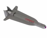
Cummings Aerospace presented its turbojet-powered Hellhound loitering munition at SOF Week 2025, offering a man-portable solution aligned with the US Army’s LASSO requirements.

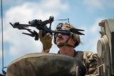
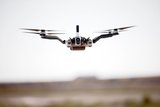
PDW has revealed its Attritable Multirotor First Person View drone at SOF Week 2025, offering special operations forces a low-cost, rapidly deployable platform for strike and ISR missions, inspired by battlefield lessons from Ukraine.
Teledyne FLIR is highlighting the emerging requirements for 'recoverable and re-usable' loitering munitions across the contemporary operating environment during this week’s SOF Week conference in Tampa, Florida.

High-performance maritime industry player Kraken Technology Group, based in the UK, has used the SOF Week conference in Tampa, Florida this week to debut its K3 Scout uncrewed surface vessel (USV) to the North American market.
Red Cat and Palladyne AI recently conducted a cross-platform collaborative flight involving three diverse heterogeneous drones.

Connect with us on socials


