


World Defense Show 2026: Northrop Grumman to present improved C2 management system
The Northrop Grumman Integrated Battle Command System is in service with Poland and the US Army with another 20 countries believed to have expressed an interest.

BAE Systems has received a contract from DARPA to develop an undersea navigation system to enhance the US Navy’s ability to provide precise global positioning across the ocean basins, the company announced on 16 May.
The contract is part of DARPA's Positioning System for Deep Ocean Navigation (POSYDON) programme.
Current navigational methods pose a detection risk for undersea vehicles as they are forced to surface periodically to access the space-based Global Positioning Systems (GPS), which cannot sufficiently penetrate seawater. Access to GPS is also limited by enemy signal jamming. POSYDON aims to replace these methods to allow undersea vehicles to navigate accurately while remaining below the ocean’s surface.
Under the contract, a BAE Systems-led team will develop a navigation, positioning and timing system designed to permit vehicles to remain underwater and navigate using integrated, multiple, long-range acoustic sources at fixed locations around the oceans.
The programme will also develop the vehicle instrumentation required to capture and process acoustic signals for navigation.
Joshua Niedzwiecki, director, sensor processing and exploitation, BAE Systems, said: ‘BAE Systems has more than 40 years of experience developing underwater active and passive acoustic systems. We’ll use this same technology to revolutionise undersea navigation for the POSYDON programme, by selecting and demonstrating acoustic underwater GPS sources and corresponding small-form factor receivers.’
Other members of BAE Systems’ POSYDON team include the University of Texas, the Massachusetts Institute of Technology and the University of Washington.

The Northrop Grumman Integrated Battle Command System is in service with Poland and the US Army with another 20 countries believed to have expressed an interest.
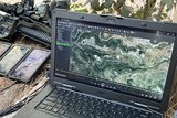
The Thales DigitalCrew package, first unveiled at last year’s Defence IQ International Armoured Vehicles conference, is designed to merge imaging and apply a layer of decision-making and observation algorithms to support crew and other personnel.

Nomad can provide militaries with real-time intelligence, saving critical time on the battlefield.
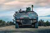
Taurus operates alongside the Israel Defense Forces’ Orion system which supports mission management across tens of thousands of manoeuvring forces, from squad leaders to battalion commanders.
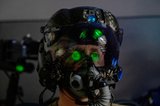
The plan for the new displays follows fresh investment in Kopin’s European facilities by Theon and an order for head-up displays in fielded aircraft, with funding from the US Department of Defense.
Persistent Systems received its largest ever single order for its MPU5 devices and other systems earlier this month and has already delivered the 50 units to the US Army’s 4th Infantry Division.

Connect with us on socials


