New vision-based navigation integration offers protection to UAS
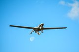
UAS fleets have increasingly been used on the front line meaning robust navigation is vital. (Photo: NATO)
ESEN has integrated its vision-based navigation system into ArduPilot providing an alternative PNT source for UAS.


ESEN has integrated its GöRDES vision-based navigation (VBN) system into the Pixhawk-ArduPilot autopilot system which allows Uncrewed Aerial Systems (UAS) to continue to function in a GNSS-denied environment.
The quest for navigation in GNSS-impoverished or jammed environments has been an ongoing defence technology challenge. In the UK, QinetiQ recently pledged £20 million (US$26 million) to building a new signal-resilience testing facility. In the US, systems such as AQNav have been using AI and machine learning to harness the Earth’s magnetic field as an alternative PNT source for when the GNSS signals – by far the most prevalent and primary source of navigation information for defence assets – go down through natural remoteness or through intentional jamming by enemy forces.
Alternative PNT for uncrewed systems will only become more important the more UAS, which are increasingly defeating legacy air defence systems designed to deal with larger aircraft, are deployed in combat situations.
Related Articles
QinetiQ to build silent hangar for UK to test GPS jamming resilience
The war in Ukraine and subsequent Ukrainian fightback have latterly depended strongly on drone stocks and operators capable of defying traditional anti-aircraft systems. Protecting the navigational integrity of UAS has, therefore, become a major concern for any force growing its fleet.
With the GöRDES integration, ArduPilot users have a UAS that will switch to VBN In GNSS-denied environments.
While in GNSS-rich environments, the VBN integration will act as a supporting or correcting source of navigational data, alongside the GNSS signals. That can be used as a guard against GNSS spoofing where the signal is essentially “stolen” by enemy forces and used to direct defence hardware to a location where it can be destroyed or commandeered.
The integration announcement came during the same week that the first Bayraktar TB2 UAS, built and operated in Turkey back in 2014, was retired from active duty and put out to pasture for training purposes. The S5 TB2 had accumulated more than 1 million flights hours across more than 750 sorties.
The two Turkish announcements bookend the first era of Turkish UAS building and development, each addressing a pressing need in UAS innovation in its own time.


More from Air Warfare
-
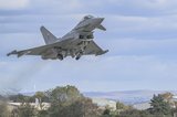
![UK MoD awards investment for full production of RAF’s Eurofighter Typhoon radar upgrade]()
UK MoD awards investment for full production of RAF’s Eurofighter Typhoon radar upgrade
The contract deal will enable the production and integration of the Eurofighter Typhoon’s new Eurofighter Common Radar System Mk 2 on part of the UK Royal Air Force’s fleet.
-
![Podcast: Critical Care episode 7 - Designing sustainment into the future]()
Podcast: Critical Care episode 7 - Designing sustainment into the future
Sustainment has long been seen as a downstream concern — something to be managed after procurement. But what happens when you flip that mindset?
-
![Singapore Airshow 2026: APAC countries explore fleet upgrade and expansion opportunities]()
Singapore Airshow 2026: APAC countries explore fleet upgrade and expansion opportunities
Ahead of the Singapore Airshow 2026, opportunities for defence firms to upgrade or replace ageing aircraft remain strong, with tactical transport, combat aircraft and maritime patrol aircraft at the top of potential procurement lists.
-
![Anduril awarded latest OPF-L contract with around $155.2 million still up for grabs]()
Anduril awarded latest OPF-L contract with around $155.2 million still up for grabs
As the US Marine Corps continues to push loitering munitions as a core battlefield tool, Shephard looks at how the latest contract award factors into future potential purchases.